NEW

Introducing EARTHLENS • Live now →

Before you build,
look closer.

Earthlens identifies properties with the potential for climate-aligned development, backed by geospatial analytics.

Our team is trusted by industry leaders

Supported in part by U.S. National Science Foundation grant NSF 11-560

Loupe aggregates complex social, governance, and environmental indicators into a unified pre-development feasibility matrix.

Asset Owners

Real Estate

Banks & Institutions

Public and NGO data
Verified records on land governance, tenure status, land conflicts, and legal boundaries sourced from NGOs, public registries, and global datasets.
Read More
Public and NGO data
Verified records on land governance, tenure status, land conflicts, and legal boundaries sourced from NGOs, public registries, and global datasets.
Read More
Real-time ecological indicators
Satellite-derived metrics including canopy loss, soil degradation, hydrological stress, and ecological fragmentation.
Read More
Site-specific analysis
Parcel-level assessment of terrain, infrastructure access, and land-use history to determine development feasibility and investment potential.
Read More

Unclear governance is an expensive risk
to discover late.

65%

Of global land lacks
formal ownership documentation

65%

Of global land lacks
formal ownership documentation

$94T

Global infrastructure investment
gap by 2040

$94T

Global infrastructure investment
gap by 2040

Inter-American Development Bank data on 200 conflict-affected infrastructure projects: 36 cancelled, 162 delayed, 116 faced cost overruns, largely from social and environmental blind spots.

Today, the legal ground is shifting towards the broader reality in which stewardship is the most effective driver of climate action, and markets increasingly economically incentivize responsible development.
2019, Ecuador
A constitutional ruling let the Waorani of Pastaza refuse state-sanctioned extraction across 500,000 acres of rainforest.
2024, Colombia
115 communities formally recognized as environmental authorities with irrefutable legal power over land use.

Reduce the unknowns between satellite imagery and final permits.

Three factors, one screen

Ecological, governance and development, with the associated risk & opportunity scoring and data framework behind each.

Shareable reporting

The reporting needed for taking sites from first screening to investment committee, so analyst and counsel work from the same ground truth.

From parcel to decision

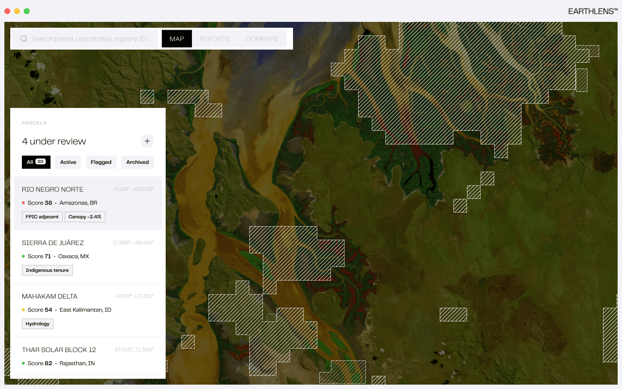
Every site under review in one list, scored and analyzed against project type and common constraints. All in one session.

Rethink pre-development due diligence.
Start on the right path.

46 Howard St. Floor 6
New York, NY 10007
Media Inquiries
pr@loupe.earth
© 2026 Loupe Ventures Group, LLC. All rights reserved
46 Howard St. Floor 6
New York, NY 10007
Media Inquiries
pr@loupe.earth
© 2026 Loupe Ventures Group, LLC. All rights reserved
46 Howard St. Floor 6
New York, NY 10007
Media Inquiries
pr@loupe.earth
© 2026 Loupe Ventures Group, LLC. All rights reserved